LRE RESEARCH:
EVIDENCE OF GLOBAL CLIMATE CHANGE

Ocean levels have varied dramatically over earths' history; exactly how much is still in question...


WHY IS THIS ON THE BOTTOM OF THE ATLANTIC OCEAN?
IS THIS ATLANTIS? > http://thesun.co.uk/sol/homepage/news/article2255989.ece

see also: http://likroper.com/underwater.html


ANCIENT RIVERS? -- Is this photo further proof ocean levels have varied dramatically throughout Earth's history? -- Notice evidence of ancient river-cut valleys on the bottom of California's Monterey bay; was this erosion caused by ice age thaw?


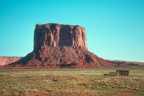
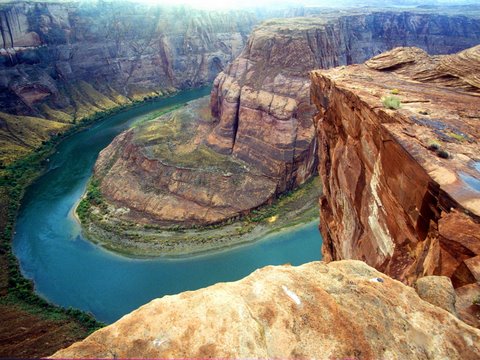
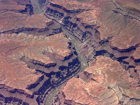
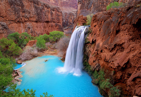
We have had 50+ ice ages, and we are now coming out of another one, which is being sped up by the increased average ice melt since the beginning of the industrial revolution roughly 150 years ago (If the planet heats up enough to cause, oh let's say...a big enough chunk of ice to break off from the south pole and fall into the ocean; the tsunami wave would be enough to wipe many of us out) -- I refute geologists who say the Grand Canyon was caused by merely uplifting land, and increased gravitationally influenced water erosion -- that is only half the answer...Why is the valley floor not raised by all the falling debris? Take into account the torrents of water which have -- at the end of each ice age -- repeatedly rushed down out of the Rocky Mountain range, into places like Grand Canyon and Sedona, Arizona etc etc etc -- QUESTIONS: If intermontane basins between ranges like those found in nevada are back-filled with great amounts of rock debris descending downslope, so that the valley floors move upwards as the ranges wear down > go to: http://rst.gsfc.nasa.gov/Sect6/Sect6_8.html > why is the grand canyon valley floor not moving upwards as well from all the rock debris descending downslope?

Earth experiences exactly one ice age each time our solar system revolves once around it's galaxial axis; meaning a mere 4 degree temperature change determined by the distance from the center of our galaxy, can mean the difference between ice age and global thawing (Earth is currently in a thawing phase) -- When ice sheets periodically cover the North American continent; it's safe to theorize most of the ice is trapped up in the northern latitudes and/or higher elevations like the Rocky Mountain and/or the Sierra Nevada ranges -- And in light of this; it's also safe to theorize California/Nevada's Lake Tahoe is an ancient lake formed by melting glaciers (California's central valley has been a large inland bay at more than one point in history); as well as The Great Salt Lake in Utah (which contains salt from an ancient saltwater ocean); these are the obvious remains of ice sheets that once helped carve (among many other geological features); the Hetch-Hetchy Valley, and the Yosemite Valley etc -- As ice periodically thaws and flows out into adjacent territories; the entire North American continent turns into one giant river bed of sorts; carving unique landscapes out of solid rock -- (see photos below)...


STONE MOUNTAIN IN GEORGIA:
the result of water erosion caused by annual glacial thawing?


SEDONA ARIZONA: that's a whole lot of terra firma GONE; so where did it go?
I do not believe merely uplifting land, rain and/or wind caused this kind of massive erosion...


GRAND CANYON IN ARIZONA


HAVASU FALLS - how beautiful is this place?


CATHEDRAL ROCK | SEDONA, ARIZONA


The result of ancient water erosion?


CAPITOL REEF GEOLOGY
http://www.nps.gov/care/naturescience/geology.htm


HOW DID THIS ROCK GET HERE AT CAPITOL REEF?
ancient ice flows deposited this rock in a very precarious position...

19 jan 2011